 |
| Kontakeika Village
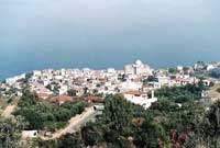
The settlement of Agios Dimitrios is located on the 4th km from Karlovasi to Samos Town and one km to the south is the village of Kontakeika. As Ep. Stamatiades mentions, it was named after its first inhabitant, one by the name of George Kotis who came to settle in the area in 1750. Even today there are many people named Kotakis in the village. |
|
 |
|
| The village has considerable arable land and the residents are mostly occupied in agriculture and mainly horticulture and greenhouses. Close to the village is the waterfront area Limanaki (small harbor) that is quite scenery. Settlements belonging to Kontakeika are: Agios Dimitrios with 146 residents, Agios Elias with 64 Agios Nikolaos with 33 and Vrises with 83 residents. Agios Nikolaos is the North most inhabited area of Samos Island and it is developed because of tourism. |
|
| Ydroussa Village
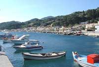
Seven km southwest of Karlovasi, surrounded by gardens, vines and forests is the village of Ydroussa. Its name comes from the many water sources that surround it (Ydor = water in Greek). Its original name was Fournoi (meaning furnace) because there were many in the area used for the production of ceramic pots, an activity that was taking place in the area since ancient times.
It is a very old village since the first attestations of its existence date back to 1625. The village has considerable arable land and the residents are mostly occupied in agriculture and mainly horticulture, greenhouses, vines and olives. In the earlier days they were also cultivating tobacco. |
|
 |
|
Agios Constantinos Village
It is a village built on the waterfront, 20 km from Samos town and on the road from Samos town to Karlovasi. It is actually comprised out of two settlements, Ano Agios Constantinos (Upper) where the homonymous church is located and which is hidden behind the forest and not visible from the Kato Agios Constantinos (Lower). |
|
| Kato Agios Constantinos was built later in the beginning of the 19th century by the sea. Upper Agios Constantinos is not inhabited for the past few years apart for the summer season. The two settlements are 500 meters apart and they are villages surrounded with lush vegetation, vineyards, orchards and plenty of fresh water. The village residents are mostly occupied in tourism and agriculture and especially viniculture and olive trees. |
|
| Ambelos Village
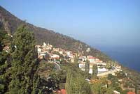
On the west end of Agios Constantinos, lies the detour that leads to the village of Ambelos and after 4 km of uphill and winding road you will reach the village. The average slope grading is 40% towards the sea in a manner that is giving the impression of a balcony over the Aegean Sea. There's a fantastic view towards the north and towards Asia Minor. |
|
 |
|
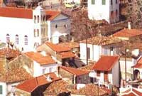
| It's a traditional village, with plenty of water, surrounded with lush vegetation, vineyards and orchards. Its old name was Nenedes, and it derives from the surname of Nenes, that was the first family that ever settled in this area and only a few decades ago it was renamed to Ambelos. |
|
 |
|
Stavrinides Village
Southeast of Ambelos, in a distance of 2 km and an altitude of 380 meters above sea level is the village of Stavrinides. The name derives from the surname of "Stavrinos" one of the village's first residents. It's a traditional village, with plenty of water, surrounded with lush vegetation, vineyards and orchards. |
|
| Manolates Village
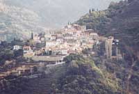
On the 19th Km of the road that leads from Samos town to Karlovasi is the detour that leads to the village of Manolates. After 6 km of uphill and winding road and through a magnificent environment you will find the village. On the road that leads to the village you'll find the areas of Platanakia and Aidonia. |
|
 |
|
| The name of the village derives from the surname "Manolas" which was the first family that settle in the area and still exists in the village. There's a fantastic view towards the north and towards Asia Minor. It's a traditional village, with plenty of water, surrounded with lush vegetation. The villagers are occupied, almost exclusively with viniculture. |
|
| Vourliotes Village
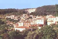
On the 16th km of the road that connects Samos Town with Karlovasi, is the detour that after 5 km leads to the village of Vourliotes. It is located on an altitude of approximately 300 meters above sea-level. It is one of the first villages of the island and it has been built at the end of 16th or beginning of the 17th century. It's first inhabitants came from the village of Vourla in Asia Minor (ancient city of Clazomenes) and from this village its name derives from.
It is located in a area with lush vegetation, covered with pine trees and vineyards. There's abundance of water and the village has many narrow streets and traditional houses. In general it's a very nice village with a great view to the north. One km before the village detour and on the beach is the settlement of Avlakia which once was the seaport of Vourliotes. Nowadays this settlement is developing on its own because of tourism.
Two km to the south and on an altitude of 460 meters, in a fascinating environment is the monastery of "Vronta" or "Panagia Vrontiani" (Holy Mary of Vronta). It has been built in 1566 by the monks (and brothers) Iakovos and Makarios and is dedicated to Holy Mary. It contains many frescos, a wonderful wood carved icon screen and many ecclesiastic utensils. The devastating forest fire of 1999 caused the partial destruction of this monastery. The village residents are mostly occupied in agriculture and especially viniculture.
There are cafes in the village square where you can enjoy lunch or dinner. From here you can also go for a walk on the Karvounis mountain following various mountain tracks. The settlements of Avlakia with 28 residents, Kampos with 75 and Vronta monastery with 31 residents also belong to the Community of Vourliotes. |
|
 |
|
Pyrgos Village
It's located 5 km west of Koumaradaioi, surrounded by hills and mountains and totally invisible by the sea. It's next to the river Amphilissus and to the west of the river Imbrassus. The name was given to the village from it's first inhabitant who came from the village Pyrgos located in the Peloponnese. |
|
| Most of the inhabitants are farmers producing mainly olive oil, wine and honey. It's a beautiful, traditional and very verdurous village surrounded by forests and vineyards. It's located 5 km west of Koumaradaioi, surrounded by hills and mountains and totally invisible by the sea. It's next to the river Amphilissus and to the west of the river Imbrassus. The name was given to the village from it's first inhabitant who came from the village Pyrgos located in the Peloponnese. Most of the inhabitants are farmers producing mainly olive oil, wine and honey. It's a beautiful, traditional and very verdurous village surrounded by forests and vineyards. |
|
| Kokkari Village
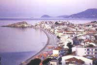
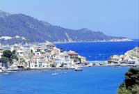
Ten (10) km Northwest of Samos town and on the road that circles the island, the coastal village of Kokkari is located. Here, two small capes form a small bay, which was in the old days the seaport of Mitilinioi village. The settlement began to build in the beginning of the 19th century on the ruins of an older Christian settlement by |
|
 |
|
| residents of Mitilinioi village and possibly from a few more villages. It was initially located on two small hills that overview the place but it soon expanded on the valley below. Stamatiades mentions that the name Kokkari derives from the many onions (kokkari in Greek means small onion) that were produced there. The same author mentions that this village, in old documents, was mentioned by the name of "Krokari" which has the same meaning. |
|
 |
|
Nikos Dimitriou in his book "Samian Folklore" mentions that the name of Kokkari derives from the name of its first settler and this seems to be the most possible explanation since there were many villages producing Kokkari (onions) at that time and not just Kokkari. Today Kokkari keeps its traditional form and is one of the more turistically-developed villages of Samos with lush vegetation, wonderful beaches and good infrastructure as well. |
|
| In the old days people were mainly occupied in fishing and agriculture while in nowadays mostly with tourism. In spite of its tourist development, Kokkari has managed to maintain its old traditional character, without bulky concrete structures. There are many rooms for rent and small hotels as well as family restaurants and picturesque taverns. A short distance to the west are the beaches "Tsamadou" and "Lemonakia", with crystal clear waters and pines all the way to the seafront. |
|
| Pandrosos Village
Four km northeast of Pyrgos you'll find the village of Mesogeios and less than a km up the road is the village of Pandrosos which is the highest one in Samos. Their old name was Arvanites (Upper for Pandrosos and Lower for Mesogeia) and they were named after their current named quite recently (40 years ago).
The origin of their old name Arvanites (old Greek term for Albanians) has various explanations. Ep. Stamatiades supports the idea that the first inhabitants of the village were two families of Albanian warriors fighting the Turks under their leader George Kastriotes which after his death were dispersed all over to escape from the Turks. Their only difference from the rest of the Samians was their linguistic idiom.
Nikos Zafeiriou supports the idea that there were more than two families but they were Greek Epirots that their neighboroughs from Pyrgos and Mavratzaioi named them disparagingly "Arvanites" (Albanians). He continues that if they were Albanians there must have been Albanian homonyms in the region while there aren't any. Moreover their linguistic idiom has nothing to do with Albanian but on the contrary it is amazingly similar to the idiom of Tinos island and that is where he identifies the origin of these two villages from. Most of the inhabitants are farmers producing mainly wine and olive oil. |
|
|
 |
|
|
|